


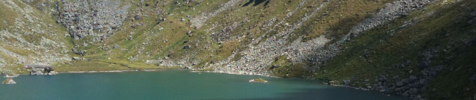
Col Termin-Louvie

SityTrail - itinéraires balisés pédestres
Tous les sentiers balisés d’Europe GUIDE+
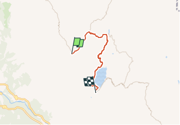

Length
3.8 km

Max alt
2659 m

Uphill gradient
80 m
Km-Effort
6.3 km

Min alt
2204 m

Downhill gradient
499 m
Boucle
No

Signpost
Creation date :
2022-02-14 08:43:47.007
Updated on :
2022-02-14 08:43:47.007
1h25
Difficulty : Easy

FREE GPS app for hiking
 SityTrail
IGN / Geographical institutes
SityTrail Plus
The world is yours!
About
Trail On foot of 3.8 km to be discovered at Valais/Wallis, Entremont, Val de Bagnes. This trail is proposed by SityTrail - itinéraires balisés pédestres.
Description
Symbol: weiss-rot-weiss
Photos


Positioning
Country:
Switzerland
Region :
Valais/Wallis
Department/Province :
Entremont
Municipality :
Val de Bagnes
Location:
Unknown
Start:(Dec)
Start:(UTM)
368389 ; 5101556 (32T) N.
Comments